(This article was written by Nelson July 1999. Rwm)
Espejo was one of the first known Europeans to travel, in 1582, down the Pecos River, then known as Rio Salado or the Salt River. He passed on the east side in the middle Pecos to avoid the bogs and quick-sands. He called this area El Mosquitero because of the many mosquitos that bred in the area’s swamps. Four large streams meandered on their flat flood plain and lazily flowed into the Pecos.
In the early 1870s, Ash Upson, one of our earliest settlers, wrote his family: “Six rivers within four miles of our door — literally alive, all of them, with fish. Catfish, sunfish, bull pouts, suckers, eels and, in the two Spring Rivers and two Berrendos, splendid bass. These four rivers are so pellucid (transparent) that you can discern the smallest object at their greatest depth. The Hondo is opaque and the Pecos is so red with mud that any object is obscured as soon as it strikes the water. Here is where the immense catfish are caught.”
In the early years, Roswell was so isolated that its chief export was the cattle raised here that could walk to market. The United States Army provided the only infusion of cash. Food was needed; therefore, ditches and dams were soon developed to irrigate the land and grow the crops.
We have no record of when development of the first irrigation began in the Roswell area. Hiram C. Fellows was hired by the U.S. Government to establish the Second Standard Parallel, now known as Second Street, in 1866. Fellows noted an acequia (irrigation ditch) running from North Spring River, and that there was considerable land under cultivation along the Hondo. About 160 ditches from these ditches have since been identified. Most of the early homesteads were proven up by using this surface water.
Nathan Jaffa, an early Roswell merchant, had trouble getting drinking water from North Spring River. It was expensive, annoying and inconvenient. Water from the surface wells was brackish, and rainwater was scarce. In 1890, he decided to drill a well deeper than had ever been drilled before, hoping to get better quality drinking water.
At 250 feet, he drilled into a hard porous limestone and he said, “water as pure as ever gladdened the throat of man bubbled up over the casing and ran away laughing in a flashing stream.” The news spread far and wide. People came from hundreds of miles around to see the phenomenon. The boom was on. People thought the artesian water flow was unlimited and permanent. Everyone who wanted water drilled. They were not too particular about the casing they used, there were no regulations then, and many wells could not be shut off. The water flowed freely, and waste was rampant.
Because of all the water, much of the land became waterlogged. Crops would not grow. In East Grand Plains, there were many fields that a horse could not walk across without bogging down. This was a predictable condition in undrained irrigated areas. The land had to be drained; by 1913, drainage district laws were passed and farmers mortgaged their lands to install drain lines. Five drainage districts were formed: Roswell, East Grand Plans, Dexter, Hagerman and Lake Arthur. Drain lines were put in over this area and most of them are still in use today.
Pat Garrett started a canal early in the 1890s to carry some of the surplus water from the Hondo to the lower valley. The project soon became too large for him to handle and the promoters from the Carlsbad project took it over and completed it below the town of Hagerman. It was named for J.J. Hagerman, the driving force behind the project, and its chief financer. The Hondo reservoir, west of Roswell, was a project built by the Bureau of Reclamation. It was built on the Artesian intake area; the bottom was porous and it would not hold water. Also, there was not enough water in the Hondo for it to be very effective. Since it was one of their first projects, and none of those facts were well known at the time, the Bureau wanted to build it. The Hondo project was abandoned before it was ever used for irrigation.
As early as 1900, some of the springs feeding the river’s flow were being reduced or were going dry. By 1908, the leadership knew something had to be done. An attempt was made to get legislation passed, but several attempts failed or were foiled until 1927. Senator Clarence Hinkle got an artesian water law passed in the Legislature. It was immediately declared unconstitutional because of some technicalities. These were pointed out by the court, corrections were made, and the revised bill was submitted and passed in 1931.
This law was badly needed because lowering of the water table created a financial crisis. The Land Banks would not loan money to farmers because they felt the water supply was unstable. At the request of the State of New Mexico, in 1920 Albert Fiedler, engineer, and S. Spencer Nye, geologist sent by USGS, began to update the work done by Cassius Fisher around 1906. By 1933, Fiedler and Nye had made a thorough study of the geology of the basin. They recommended the basin be closed. This Fiedler-Nye study has become the Bible of the Artesian Basin, but it did not answer all of the important questions.
The new water law has since withstood a number of constitutional attacks. It was based upon the New Mexico Constitution’s surface water provisions. The law required a defined basin. The problem was, no one really knew the limits of the basin. Over the years, this basin has been declared and redefined and studied as thoroughly as any existing water system.
Strong powers were given to the State Engineer to administer the law. The Pecos Valley Artesian Conservancy District was established to oversee the local administration. The basin was closed to further development in 1933. No further water development was allowed. The State Engineer caused detailed maps to be made of all the irrigated land at the time the law became effective. This was called the Dallas Report.
The next problem arose; around 1928, shallow water was discovered. It was a sheet of water that lay between the artesian aquifer and the surface water. This water did not flow to the surface, but could be pumped. It came from upward leakage of the artesian aquifer and downward percolation from the rain and irrigation water on the surface. It was not until the Peerless pump was developed in the 1930s that this source could be fully exploited. The Peerless pump put a small vertical turbine pump in the bottom of the well, and water could be raised from greater depths. Until this time, the centrifugal pumps used could raise water from only a little more than 25 feet, and deep pits were dug to lower the centrifugal pumps to the water.
Shallow water development began in earnest in the late 1930s, until it was suspended during World War II when all resources were devoted to the war effort. Shallow water development began again after the war and the State Engineer declared a shallow water basin in 1948 that effectively limited further expansion of this water extraction. However, that was after about 15,000 acres of new water was developed in the northern extension of the basin. That extension was north of the Clovis Highway.
It was obvious that the artesian water basin was over appropriated. At first, people thought the artesian basin, the shallow water and the surface water were completely independent of each other. It soon became obvious, however, that they were just different locations of, and mechanics for procuring, the same water.
From the Dallas survey, water rights were identified based upon what water was being used in the 1930s when the law became effective. The State Engineer then called for an adjudication of these water rights. This took a number of years to complete. In the adjudication suit, presided over by Judge LaFel E. Oman, all the rights were identified and priorities were established.
The State Engineer offered three acre-feet of water as the proper duty. No one knew what three acre-feet really was, but experience has shown it is inadequate for efficient farming in this area’s climate, growing seasons and crops. Judge Oman authorized 3.5 acre-feet for each acre of water rights, dragging (the then) State Engineer Steve Reynolds through the door sideways.
The next obstacle was the Pecos River Compact. Texas — with the Pecos River also flowing into their state — wanted to protect their water source for their Pecos, Texas agricultural area. They began agitating for a compact in the 1920s. Texas threatened lawsuits to get the federal courts to take over the river administration. Finally, a compact was drawn up between Texas and New Mexico that New Mexico thought she could live with, and she reluctantly ratified it.
Ever since, that Pecos River Compact has been a bone of contention between the two states’ residents.
(The Taylor family) moved from Memphis, Hall County, Texas in 1901. Tired of making a living at dry-land farming and cattle raising, Myrtle’s parents, grandparents and her dad’s half-brother, Robert, moved to Roswell, New Mexico, where a new life began for the children. In the fall, the three oldest — Mary, Myrtle and Bill — started to Public School. They had never before been to school; there were no school buses in those days, and the family (had) lived too far for the children to walk. They had learned to read, write and figure because their parents taught them. They made rapid progress in Roswell.
Then came summer vacation 1902; they visited relatives in Texas. Vacations can’t last forever, so they were soon on their way back to Roswell. On their return, they were met by friends and neighbors who were glad they were home in time to go for buffalo berries, which were ripening. Never having heard of them, there were many questions. What are they? Do buffalos eat them? Will we see buffalos? Just you wait and see. So the next day, Old Molly was hitched to the spring wagon, baskets, lunch pails and children, along with two rolls of canvas and a tub, were loaded in and they were on their way toward the foothills where they knew the berry trees grew.
About noon, they began to see the red berries. Finding a tree loaded, they stopped in the shade of another and quickly unloaded the canvas, spreading it on the ground under the big tree. With long sticks, they began beating the limbs and shaking the tree. The berries began to shower down, and of all things, a little brown bear came tumbling down, uttering terrified sounds. Hard to tell who was the most frightened, the bear or the children. He lost no time getting away from there. Nor did the children, scooping up the berries and keeping a look-out for the mother bear. They soon filled their pails and tub and were on their way home. Now, their mother had plenty of berries to make jelly.
Then it was fall and time for school again. So many new families had moved in, there just wasn’t room for all the children in the city school, so a line was drawn through the southern part of town and all children south of that line had to go to a country school south of town. That included the Taylor children. Work was begun at once, building more rooms to the Public School. It was soon after Christmas when the children were able to return to the city school.
Then it was vacation time in the summer of 1903; what a summer that would be. (Because there was) So much rain up in the mountains west of Roswell, the people were getting uneasy, for the town was in the low land east of the mountains. Then came a terrific rainstorm east of Capitan Mountain. The runoff came toward the town, down the town, down the Hondo River. This river bed had been dry so long that the banks had worn down. Though some attempts had been made to repair them, they were not solid enough to contain the flood waters coming down. They soon flowed through the town up to three feet deep and more in some places. The Taylor homes were in the direct path of the water, washing George Taylor’s home from the sidewalk back to the alley fence. The two Taylor families escaped in a delivery wagon, seeking refuge in their furniture store downtown. Though it was made of adobe brick, it withstood the rain and flood water very well. Only a few big cracks appeared in the walls.
Their main concern was for food and water until George opened a hole in the wall between the store and the meat market next door. For three days, they were kept closed in, nothing to do but to watch the adobe houses around them melt down in the floodwaters. One was a big two-story opera house across the street. (After) three days, the grandparents could return to their own home, but George’s family had to move into an adobe house on higher ground out of the flood district, where we lived for a year until the summer of 1904. Though the town was nearly all washed away, the children were able to attend the Public School full term fall of 1903 and spring of 1904.
In May 1904, the family moved to Steamboat Springs, Colorado.
Henry Ford is often quoted saying, “History is bunk.” Well, with all due respect to Mr. Ford, I believe that in terms of history, he was wrong. History does matter and not in just the usual “If we don’t know the past, we are doomed to repeat our mistakes” sense. Now granted, many of us often want to agree with Henry Ford, and we often hope he is right. The stock market is one place we thought history no longer operated. It wasn’t too long ago that many analysts told us we were in a completely new business cycle. The business cycles of the past were no longer operating in the new dot-com business environment of the present. As the Dow Jones broke record after record, we all pretended that it could continue to go up forever. But the business cycles of the past did matter. And many of us found out, to our disappointment, that the historical cycles were all too real and still operating.
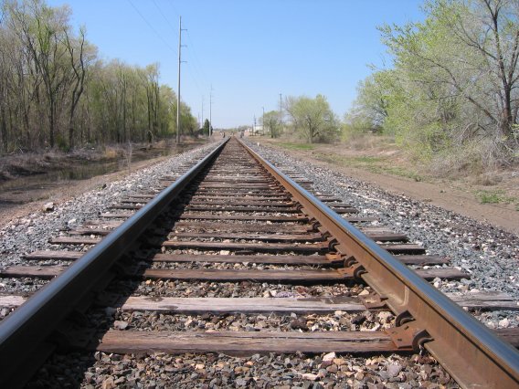
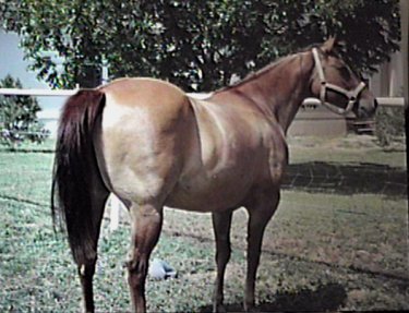
Consider a more interesting example from deeper in our history. The standard gauge of the United States railway network is 4 feet, 8.5 inches. That is, our nation’s railroad rails are spaced 4 feet, 8.5 inches apart. Now why would we base the width of our national railroad line on a dimension that odd? The reason we use that measurement is because our railroads were essentially built by English expatriots. We adopted the English system. So why did the English build their railroads with rails spaced 4 feet, 8.5 inches apart? They built them to that specification because builders of their first railroads used the same tools and dimensions that had been used in building English carriages and wagons. And those carriages and wagons were built with a wheelbase that would fit the already existing ruts established throughout the long-distance English roads. So who built the English road system and where did those ruts, spaced at about 4 feet, 8.5 inches, come from? That answer is the same for most of the old road systems found throughout Europe. The ancient Romans built the first road network throughout western Europe in order to move the legions efficiently across the empire. And those old ruts? Imperial Roman chariots initially started them. Built by specification throughout the empire, Roman war chariots had a wheelbase of about 4 feet, 8.5 inches. So then you have to ask, why would the Romans build their chariots with that odd number for a dimension separating the wheels? The answer to that question is based on the need for a chariot to fit efficiently behind two warhorses. The Roman war chariot was built to accommodate the rear ends of two Roman horses. In other words, America’s railroad system has a critical dimension based upon the width of two ancient horse behinds.
Now, some argue that there is a further consequence of this little history. The American space shuttle is powered by booster rockets manufactured in Utah by a government contractor. One of the critical components they manufacture for the space shuttles are the shuttle rocket boosters, or SRBs. Apparently, the engineers would have preferred to build those rocket boosters a little bigger than they are. But they are required to ship these SRBs by rail to Florida. The railroad line runs through a tunnel in the Rocky Mountains. The tunnel was excavated to accommodate the standard railroad gauge of 4 feet, 8.5 inches. Those solid rocket boosters, loaded onto a railroad car, could only be built a certain dimension if they were going to fit through the tunnel. So, it could be said that the world’s most sophisticated device, a vehicle that travels in space, is still tied to those old Roman warhorses from about 2000 years ago.
These are truly the ties that bind us. The past, far from being irrelevant or only abstractly important, seems to have an influence that echoes through the long and rutted road of history.
Another, darker, example would serve to illustrate this idea for our time. When Christian knights captured Jerusalem during the First Crusade, they immediately burned to the ground the city’s largest synagogue, filled with Jews. They then proceeded to kill every Muslin they could find — man, woman or child. This horrific event is still remembered and talked about throughout the Middle East today. Clearly, if two Roman warhorses can have such a long-lived influence on our transportation systems, who’s to say how much impact this event, and others like it, could still have on our world today.
Clearly, history still matters. We give lip service to knowing our past in order to avoid the mistakes of our past. But if we truly realized how much history still influences our world community, we would take it more seriously, and we would take more seriously the need to understand our history. Only when we finally understand the history that led us to our present will we be finally able to climb off of that old chariot, pulled by those old warhorses dragging us down the same old rutted roads. Perhaps then, we will gain the understanding, the patience and the forgiveness that will allow us to create the kind of world all of us have long been seeking.
A future issue will have an article about Toastmasters International, which has clubs around the world, including near where you live. Civic and service clubs benefit others, primarily those in their own local communities. Toastmasters International, while not a civic or service club, also provides valuable benefits; beneficiaries are the clubs’ members. Membership in Toastmasters International, which is open to everyone, empowers Toastmasters with continued self-improvement and self-confidence, and helps them acquire greater management and listening skills. For information about a club near you, Email me at editor@roswellwebmag.com RWM
The story of the origin of the gauge used for the U.S. railroad track is one I have heard for years. While humorous and amazing (which facts often are), I never doubted that the story was true. While at Hunter-Creek Farms wanting to get a photo of a horse’s behind to accompany this article, Kerry Hunter said the story actually is an urban legend, but like most legends, buried in this one are some facts. Hunter suggested I go to the Internet to check out this and many other tidbits. For speakers, writers and people who just find facts fascinating, I recommend it as a great resource for all kinds of information. To read documented, interesting and fun-filled information on this subject, the origin of the gauge of the U.S. railroad and modern rocketry.